





Answers to common questions on measuring Earth's field with a phone: expected strength, a flip trick that cancels sensor offset, what disturbs readings, and accuracy.
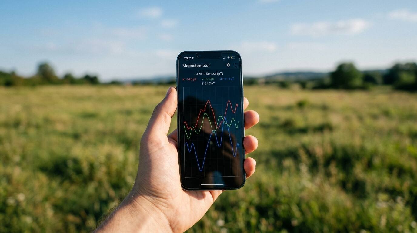
Open the magnetometer experiment in phyphox and one of two things happens. Either live traces for three axes appear, or the entry is greyed out, which the eCampusOntario lab guide takes to mean the phone has no magnetometer. If the traces appear, the phone can measure Earth’s magnetic field, with some caveats about everything near it.
The questions below are the ones people tend to ask when they try this: what number to expect, how to cancel the phone’s own bias, what ruins a reading, and how much to trust the result. Each answer draws on a university lab guide, a published paper or NOAA’s geomagnetism pages. Where no source gives a figure, the answer says so.
What field strength should I expect to read?
NOAA’s National Centers for Environmental Information puts the intensity of Earth’s field at roughly 25,000 to 65,000 nanoteslas, or 0.25 to 0.65 gauss. In the microtesla units that phone apps use, that is about 25 to 65 µT; the conversion is this article’s, since the NOAA page gives nanoteslas.
The same page says the field changes with both location and time. Local anomalies can be large: one mapped area of Minnesota has a 16-degree east declination anomaly. NOAA’s calculators, listed on its geomagnetism site, give the expected value for a given place.
How do I measure it with phyphox?
The eCampusOntario magnetic-fields lab lays out the procedure. Hold the phone at least 1 m from walls, metal and magnets, and carry no metal or magnetic items yourself. Start the magnetometer and tilt or turn the phone until the y component is at its maximum positive value, with x and z near zero. That orients one axis along the field.
- Check the app’s accuracy readout. If it does not say high, move the phone in a figure-8 to calibrate it.
- Hold the phone still, with your hand resting against your body to reduce motion.
- Record, stop, and export the data as CSV.
- Repeat at three locations.
- Plot field against time, mark the segment you average, and state the uncertainty.
How do I cancel the phone’s built-in offset?
A paper in arXiv, “Measuring Earth’s Magnetic Field Using a Smartphone Magnetometer”, shows a neat trick. Measure one axis with the phone in its normal orientation, then flip the phone so the same sensor reads the opposite direction. The sensor’s constant offset appears with the same sign in both readings, while the true field flips sign, so adding the two readings cancels the offset and half the sum is the Earth field.
The authors used a Motorola Moto g6 Plus running the Physics Toolbox Magnetometer app, and measured each of the three axes separately.
| Axis | Normal (µT) | Flipped (µT) | Earth field (µT) |
|---|---|---|---|
| x | 47 ± 1 | −53 ± 1 | 50.0 ± 0.7 |
| y | 51 ± 1 | −52 ± 1 | 51.5 ± 0.7 |
| z | 51 ± 1 | −49 ± 1 | 50.0 ± 0.7 |
Combined in quadrature, the final value was 50.5 ± 0.4 µT, which the authors call reasonable for Oslo. The paper names no reference source and gives no percentage comparison, so the result shows consistency, not verified accuracy. Compare any measurement of your own against the NOAA figure for your location.
If your app reports three axes without any orienting, the size of the total field is the square root of the sum of the three squared readings. That is ordinary vector arithmetic, not a method from the sources, and it works only after the offset problem above is handled. The lab’s own statistics are simple: average a steady stretch of readings and use the standard deviation as the uncertainty.
What disturbs the reading?
Anything magnetised, conductive or carrying current can change what the sensor sees. Sources in this article name these specifically.
- Buildings. The arXiv authors got inconsistent results indoors and suspected permanent magnetisation of the building, such as iron rebar in concrete. They moved outdoors.
- Metal equipment. Their camera tripod had magnetised metal legs that interfered, so they held the phone by hand.
- Nearby metal and magnets. The eCampusOntario lab asks for 1 m of clearance from walls, metal and magnetic objects, and says to carry none yourself.
- Poor calibration. Phyphox reports an accuracy level; the lab says to recalibrate with a figure-8 if it is not high.
- Hand movement. Holding the phone by hand causes readout fluctuations, per the arXiv paper, which is why the lab advises resting your hand against your body.
- Electric current. In the same lab, briefly closing a circuit through a small coil of wire over the phone produces spikes on the z component.
One caution from that lab: do not leave the coil circuit closed for long, because the battery will get hot and run down faster. A neodymium magnet test has its own warning in the lab text: if the reading suddenly drops, the magnet is too close to the phone, so back it away.
How close to the true value can a phone get?
Two numbers help. The arXiv paper reports a stated uncertainty of ±0.4 µT on its final result, built from individual readings taken to the nearest µT. NOAA says its own model is accurate to about 200 nanoteslas for the intensity elements, which is 0.2 µT.
None of the sources used here offers a published comparison of several phones against a reference instrument. Without one, no honest percentage can be quoted for “a phone”. The practical advice is to calculate your uncertainty from repeats, as the lab asks, then look up the NOAA value and see whether the two agree within it. Phone placement on the device is not critical, the paper adds, so the sensor’s position inside the case matters less.
Why do two spots give different numbers?
Three explanations are on the record. First, the field itself varies with place; NOAA notes that anomalies can be large. Second, buildings and equipment distort it locally, as the arXiv authors found with rebar and a tripod. Third, a phone that has not been recently calibrated can report a skewed value. Taking readings in three locations, as the lab does, separates a real geographic trend from an artefact of one awkward spot.
Outdoors, clear of walls, metal and magnets, is the safest default. The arXiv authors moved outside after inconsistent indoor results, and the lab’s 1 m rule turns that habit into a measurable distance.
Where is the sensor inside my phone?
The eCampusOntario lab has a way to find out. Open the magnetometer in absolute-field mode, place a non-metal spacer about 3 to 5 cm thick between a neodymium magnet and the phone, and slide the magnet and spacer along the surface until the reading peaks. The peak marks the sensor, and the lab asks you to mark it on a photo of the phone.
What do declination and inclination mean?
NOAA defines declination as the angle between magnetic north and true north, positive to the east. Inclination, or dip, is the angle between the horizontal plane and the field vector, positive downward. The magnetic equator is where inclination is zero, and the magnetic poles are where it is 90 degrees, with horizontal intensity falling to zero.
That matters to your measurement because the field is not horizontal in most places. In the phyphox lab, a separate inclination run lasting about 3 to 5 seconds records the tilt. NOAA’s declination calculator accepts a location or US zip code, and its compass bearing correction tool converts a compass reading to a true bearing.
Where to go next
The same field that moves your phone’s compass needle shields the planet. x9m8 has covered the Smile mission built to map Earth’s magnetic shield, and its explainer on how GPS works covers another set of signals your phone senses.
Sources