






A 2026 Geology paper links the Grand Canyon’s missing billion years to a vanished rift-flank cliff from Rodinia’s breakup. Here is the evidence, the arithmetic and the caveats.
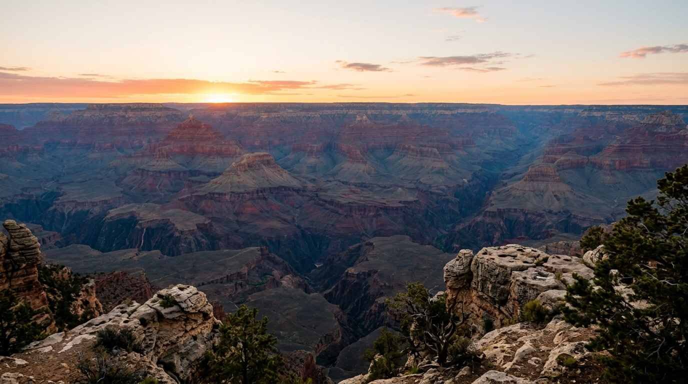
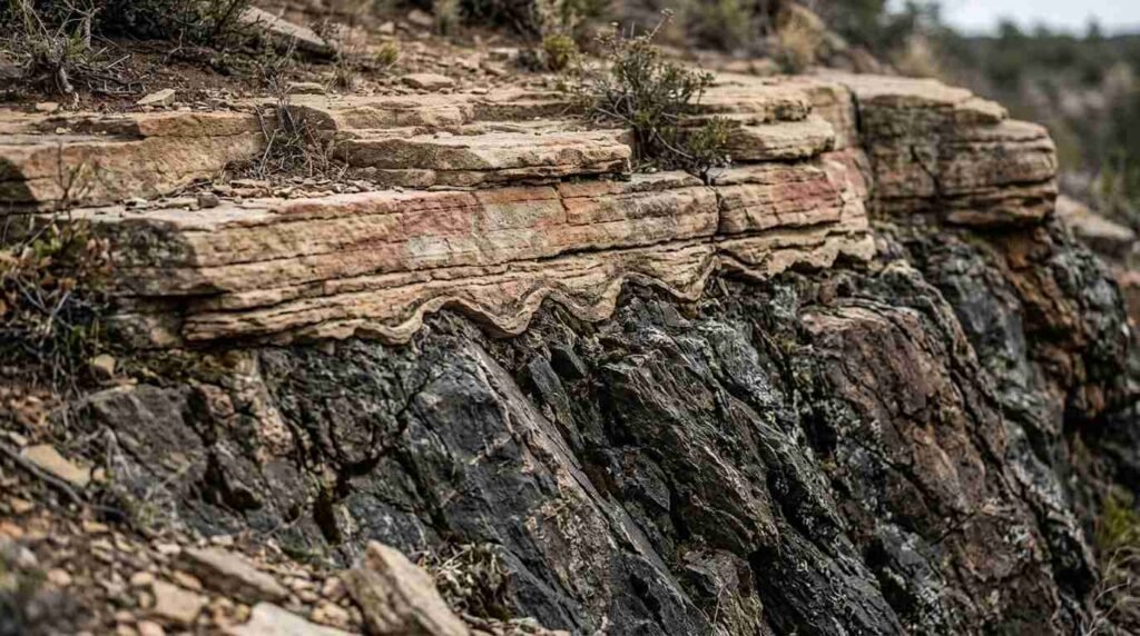
Near the bottom of the Grand Canyon, flat-lying sedimentary layers rest directly on crystalline basement rock, and the contact between them hides more than a billion years. That missing interval is the Great Unconformity, one of the largest gaps known in Earth’s rock record, and its cause has been argued over for well over a century.
A paper in the journal Geology adds a new candidate. Led by Thomas Gernon at the University of Southampton, the team proposes that a cliff roughly a kilometre high, running for thousands of kilometres along western North America, formed as the supercontinent Rodinia broke apart about 800 million years ago. As that escarpment retreated inland, it stripped away kilometres of rock and left the basement exposed long before the canyon existed.
The idea rests on computer models, not on a new set of rock measurements, and the sources I could reach describe it with appropriately cautious language. This post sets out what the paper says, how it fits with an earlier dating study, and where the weak points are.
What an Unconformity Is, and Why This One Is Famous
An unconformity is a surface where rock is missing: layers were eroded, or never deposited, before younger layers arrived on top. The Grand Canyon holds about two billion years of Earth history, and more than half of that record appears to be absent at the Great Unconformity.
The feature is not confined to Arizona. Reporting on the earlier dating work notes that it turns up around the world, always in rocks about 550 million years old or older. Whether one planet-wide cause explains it, or many local ones that happen to line up in time, is the heart of the dispute.
The Earlier Evidence: Helium Trapped in Zircon
In 2021, a team led by Barra Peak, then a doctoral student at the University of Colorado Boulder, took a different route (the study was reported in Geology and covered by Live Science on August 26, 2021). They did not date the rock layers directly. They measured when rocks beneath the gap cooled, because cooling marks the moment overlying rock was stripped away.
The tool was helium in zircon crystals. Uranium decay produces helium, and the helium escapes when the crystal is hot, so the amount retained in rock of known age records when it reached the near-surface. Across eight locations in the canyon, the answer varied sharply. The western canyon cooled about 200 million years earlier, on average, than the eastern part. By the team’s reading, the western half reached the surface around 700 million years ago and the eastern half around 500 million years ago. The size of the gap ranged from about 250 million years at its smallest to 1.2 billion years at its largest, and values changed by tens to hundreds of millions of years across spots only a few dozen miles apart.
The conclusion at the time was that no single global event was needed. Rifting during Rodinia’s breakup left a patchwork of faults, highs and basins, and the timing of erosion differed from place to place.
The 2026 Proposal: A Cliff That Retreated for Tens of Millions of Years
The new study, “Exhumation of Grand Canyon’s basement along the Great Escarpment of Laurentia” (Geology, 2026, DOI 10.1130/G55133.1), comes from Gernon, Thea Hincks, Elias Rugen, Sascha Brune, Jean Braun and Stephen Marshak, working across the University of Southampton, the GFZ Helmholtz Centre for Geosciences, the University of Potsdam and the University of Illinois Urbana-Champaign. They combined plate-tectonic reconstructions with landscape-evolution models that follow how terrain wears down over roughly 200 million years.
The result is a rift-flank escarpment, a steep scarp of the kind that borders modern rifted margins in South Africa and Brazil. In the models it forms around 800 million years ago, stands about a kilometre high (some coverage says up to 2 kilometres), and stretches across what is now Arizona, Utah, Idaho, Wyoming, Colorado, Texas, Oklahoma, Arkansas, Missouri and Illinois. Over tens of millions of years the scarp migrates inland. Near it, the models remove as much as 8 kilometres of rock. About 200 kilometres away, the loss is 2 kilometres or less.
That gradient is the paper’s selling point. It predicts that the amount of missing rock should vary strongly with distance from the old cliff line, which matches the patchy pattern seen in the field. Earth.com reports that the canyon sat roughly 400 to 600 kilometres inland, farther than the 336-kilometre average for escarpments of the later Gondwana breakup, although the coverage does not spell out the reference point for that distance.
One distinction is easy to miss. The basement was exposed nearly a billion years before the Colorado River carved the canyon, according to the university’s account, and most of the modern canyon had been cut by about 70 million years ago. The escarpment explains the bare basement, not the canyon.
The Numbers Side by Side
| Source | Claim | Key figures |
|---|---|---|
| Peak et al., 2021 | Erosion timing varied across the canyon | Western canyon cooled about 200 million years earlier than eastern; gap 250 million to 1.2 billion years |
| Gernon et al., 2026 | A retreating rift-flank cliff stripped the rock | Cliff about 1 km high (up to 2 km in some coverage), about 800 million years ago; up to 8 km removed nearby, 2 km or less about 200 km away |
| Independent estimates cited in coverage | Large amounts of rock vanished from the region | 5 to 10 km regionally; about 6 km in a Missouri study; western canyon rocks cooled about 150 °C over 200 million years |
| Oldest rock above the gap | Sandstone resumes late | 508 million years ago, about 30 million years after seas flooded other parts of the continent |
Reading the Numbers
Two quick calculations help calibrate these figures. They are mine and rest on simplifying assumptions.
If 8 kilometres of rock came off over 200 million years at a steady pace, the average erosion rate would be 40 metres per million years, or 0.04 millimetres a year. That is slow in daily terms and still enough to remove a mountain belt. The models almost certainly do not erode at a constant rate, so the true pulses were faster and the lulls slower.
The cooling evidence converts to depth through the geothermal gradient. A drop of 150 °C corresponds to more than 6 kilometres of removed rock, as the coverage states, which implies roughly 25 °C of cooling per kilometre of exhumation. That is a typical continental gradient (background knowledge, not from the sources), so the pairing is at least internally consistent.
Snowball Earth, and Why It Isn’t Necessarily a Rival
A competing family of explanations credits glaciation during the Snowball Earth episodes, when ice sheets scoured continents. Gernon calls that framing a false choice. His argument is that a mile-high cliff gives glaciers the steep ground they need, so the escarpment would have come first and the ice would have done part of the carving. Whether the data can separate the two is not addressed in the sources I read.
Where the Claim Is Fragile
- The escarpment is a proposal built from models, not a measured landform. The team itself says the model is not meant to explain every feature of the canyon.
- Cliff height differs between accounts: about 1 kilometre in the university release as relayed by ScienceDaily, and 1 to 2 kilometres in other coverage. I could not check the paper itself to see which figure it gives.
- The pattern outside North America is an open question. The authors say the gap seems concentrated in the ancient core of Rodinia, which leaves other continents unexplained.
- The coverage I could retrieve reported no independent critique, so the response of other specialists is unknown.
- Erosion depths come from model output. How closely the models match field data was not described in the accounts I read.
What Would Settle It
Gernon points to a straightforward test: dating rock beneath the gap across the middle of the continent. If the proposed escarpment retreated inland, the exhumation ages should step progressively younger away from the old cliff line, and outcrops in Texas, Oklahoma and Missouri may preserve the remnants. My own addition is that low-temperature thermochronology, the same helium-based family of methods used in 2021, is a natural way to run that test, since it records when each block of rock last cooled.
Frequently Asked Questions
Is the Great Unconformity the same age everywhere?
No. The 2021 helium-in-zircon work found differences of tens to hundreds of millions of years between locations a few dozen miles apart, and the 2026 paper’s retreating cliff is one way to explain such variation.
Did the escarpment carve the Grand Canyon?
No. The proposed cliff exposed the basement rocks about a billion years before the Colorado River cut the canyon. The two events are separate.
What was Rodinia?
A supercontinent that, per the 2021 coverage, assembled about a billion years ago and broke up around 750 million years ago. The 2026 study dates the start of the rifting and the escarpment to roughly 800 million years ago.
Sources and Verification Notes
- University of Southampton release as carried by ScienceDaily, August 20, 2026
- Earth.com coverage of the Gernon et al. study, August 27, 2026
- Interesting Engineering coverage, August 20, 2026
- Live Science on the 2021 Peak et al. dating study, August 26, 2021
- Paper DOI: Gernon et al., Geology (link from the coverage; the page would not open for me)
Verification notes: I could not open the paper itself, so every figure from the 2026 study comes from press releases and news coverage, which disagree on the cliff height. The Peak et al. details come from Live Science’s 2021 article, and I did not find the original paper. The 40 m per million years and 25 °C per kilometre figures are my arithmetic, and the typical-gradient remark is background knowledge.